


Maps & Applications
GIS Maps & Online Applications
Explore Online GIS mapping applications with information on Schools, School Districts, ESDs, and more.
Washington State Schools Explorer
(Note: This application will not work properly with Internet Explorer. Please use a modern web browser such as Chrome, Firefox, Edge, etc.)
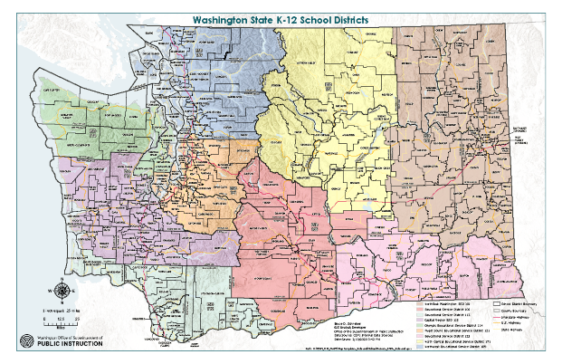
School Districts and ESDs 17 x 11 | 24 x 17 | 36 x 24 | 42 x 34
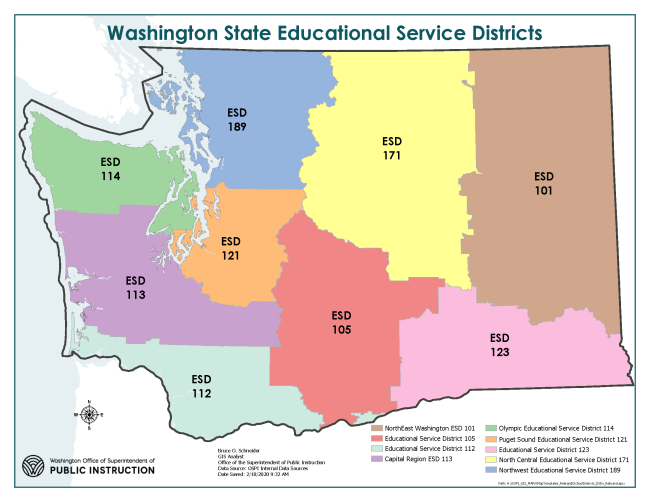
Educational Service Districts
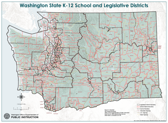
School and Legislative Districts
Search for Public Schools
Database maintained by the National Center for Education Statistics.